![]()
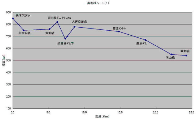
The altitude of the road along the Tonegawa River investigated by maps
is shown below.
(The Acrobat Reader Software is necessary to see the pdf files)
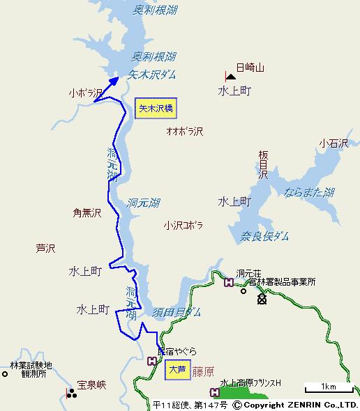
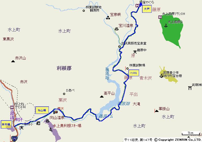
The route where the altitude line is plotted, is shown below.
Idea of this sheet was proposed by Mr. Tamao