![]()
| Mt. Tskuba | ||
 |
Nearest Point Distance Address Phone Number Open Closed Admission (@March 2002) Route map |
Left bank 45.7Km point of the Kokaigawa River 21,100m Tsukuba Tsukuba-City Ibaraki-pref. -------- -------- -------- Free |
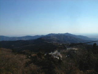
| This is a view of Kazekaeshi pass from a road just under the Tsutsjiga-oka
Hill. Beyond the pass, there is Omotetsukuba Skyline. There are two routes from Iwai-bashi bridge to Kazekaeshi pass. Route 1: Iwai-bashi bridge --15.4Km(including 4.0 Kilometers of slope) --Fudo pass -- 5.7Km-- Kazekaeshi pass. Route 2: Iwai-bashi Bridge--14.8Km(including 6.1 kilometers of slope) -- Kazekaeshi pass. The slope on the route 2 is said to be harder. I was afraid of passing on the Road R125, because street was congested with cars, and sidewalks ended off here and there. |
||
 |
 |
|
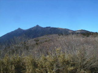
| View from the Omotetskuba Skyline(mountain highway). The left top is Mt. Nantai and the right top is Mt. Nyotai, and the right hill in front of those tops is Tsutsujiga-oka. Mt. Nyotai and Tsutsujiga-oka hill is connected by the aerial cable way. Unfortunately, bikes nor pedestrians can not go up above the Kazekaeshi pass. Mt. Nantai and Tsukuba-jinja Shrine is connected by the cable way. |
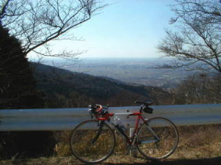
There was a tollgate of Omotestskuba Skyline. The toll for bikes was 30 yen. Now it is changed to be freeway. |
|